Sunday, August 19, 2012

Penobscot Bay: Muscle Ridge Channel, Dix and High Islands


Saturday morning (8/18), we motored out of Harbor Island in a light drizzle, headed for Penobscot Bay. Our route took us ESE between Barter and Thompson Islands, south of Hupper Island, Hart Island, and tiny Black Rock, and ENE past Mosquito Island (didn't stop in!) toward Muscle Ridge Channel. Early on, we did raise the main and genoa briefly, but the NW wind was light and fluky, so we gave up on sailing and just motored, charging our batteries.

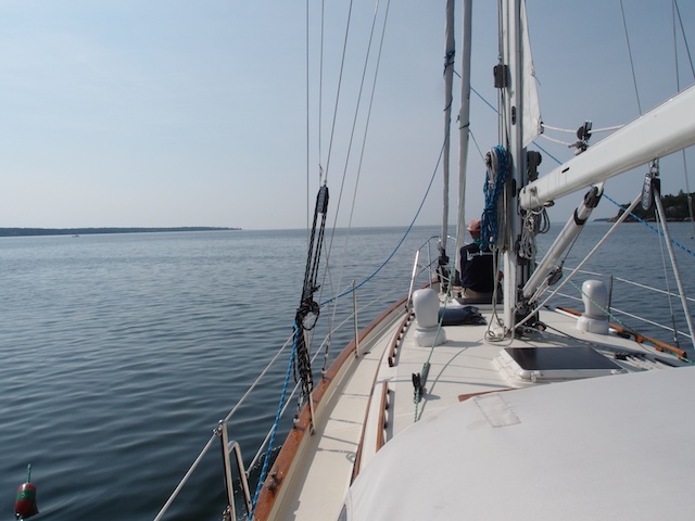
Entering Muscle Ridge Channel; why are all those boats
headed the other way?
Muscle Ridge Channel is a well-marked and popular passage that wends its way northeast-southwest among many small islands and shoals. Big ships use the much larger and deeper Two Bush Channel to the east, leaving Muscle Ridge for cruisers, pleasure boats, and fishing boats. We entered Muscle Ridge on an ebbing tide, which turned out to be a mistake. The southwest-trending current was fierce against us, to the tune of 1.5 knots – almost a third of our cruising speed. No wonder most of the sailboats we saw were headed in the opposite direction! We cranked up the engine rpms and soldiered on, doing our part for the economy by blasting through extra diesel. Double-crested cormorants outpaced us, and even migrating monarch butterflies matched our speed (although they, too, were smart enough to go the other way). Sigh.
Whitehead Island Light near the entrance to Muscle Ridge
We had thought of heading farther north through Owls Head Bay and into busy Rockland Harbor, for a variety of reasons, but after grinding past island after beautiful island in Muscle Ridge, we decided we weren't that interested in commerce and crowds and didn't need groceries or water yet. (Or diesel, our channel-chugging notwithstanding.) So after a quick re-read of the cruising guides and charts and a quick re-check of the wind and weather forecasts, we turned SE out of the channel into the anchorage between Dix and High Islands.

At anchor by Dix and High Island; view of Birch Island to
the south
The anchorage is really just a shaped space created by three small islands (Dix, High, and Birch), and both the guide and the chart show it to be rather tight, but it gets high marks for aesthetics and protection from prevailing southwesterly winds. There were four sailboats already anchored when we arrived, so we anchored out at the edge of the space. Curtis wasn't happy with this spot, however, since this location left us more exposed to the main channel's current and boat wakes than we would like. While we looked around and discussed our options, three of the anchored boats suddenly departed as a group, leaving the inner harbor space open. Bingo! We pulled anchor – actually, Sue did, to try her hand at using the manual windlass – and motored farther in to reset it. Done. Or at least we thought so, until we swung on the wind a bit later and found ourselves right on top of several lobster pot buoys. Not good. Sue worked the windlass again, bringing the anchor up to just below the water's surface, and we motored forward another 30 feet. Down she went a third time (the anchor, not Sue), setting nicely.

(In the middle of all this anchoring, Curtis had to do some impromptu windlass wrestling to get the gypsy – the turning piece that holds and feeds the links of chain – to work properly. It had suddenly decided it would raise but not lower the anchor. Sue found a helpful post on Bella Star's blog [www.svbellastar.com] about the same issue, with the same Hercules windlass; she also opened the owner's manual to the exploded parts diagram to identify the “O-cone” that was probably stuck between the gypsy and the clutch nut. Curtis remembered having read that same post a few months back, but at the time he hadn't needed the specifics.)

Stacked granite blocks from the old quarry on High Island
What a great spot! After straightening up the cockpit, putting away PFDs, and entering engine hours and lat/long coordinates in the logbook, we took hot showers with our six gallons of engine-heated water and relaxed in the cockpit with adult beverages. Quiet water, birds all around, beaches and granite boulders and deep green conifers everywhere we looked. High Island to our east is the site of a 19th-century granite quarry; we'll probably explore it on Sunday by dinghy. Curtis picked out the top of Owls Head Light far to the north and east. Sue spotted an osprey nest with three birds on it and a fourth nearby. A first summer common loon preened just off our starboard side, and another loon called in the distance. Black guillemots dove and surfaced, eating what looked like clams or mussels. A passing bald eagle rolled and shook its talons at the osprey that was hassling it. 

Mainstay Provision Co. making the rounds of the anchorage
A small wooden boat motored up alongside us, driven by a woman from nearby Andrews Island. She was the sole proprietor of Mainstay Provisions (207-691-9227), a service delivering fresh produce, baked goods, salads, and entire lobster dinners to visiting boaters and cruisers. Curtis marveled at the big cookpots and gas burners set up in the stern of the boat. We chatted with her for a bit, bought two ears of corn and a three-bean salad, and wished her success as she wended her way through the anchorage.

Working on the blog at sunset
Dinner of grilled turkey tenderloin
over couscous, with corn and
fresh tomatoes
Two days of cruising, and Sue is already ready for a day off – or rather, a day on the boat, but stationary. Curtis isn't arguing one iota. On Sunday morning, a brisk NNE wind has started up, as forecast, but by midday it's supposed to calm back down. We plan to stay here until Monday, exploring nearby islands and working on small projects. Curtis spies a big seal haul-out on a nearby islet; Sue looks at all those lolling mammals and thinks, “Great idea.”

Muscongus Bay: Harbor and Hall Islands


Setting out on our first cruising adventure
We departed South Bristol Harbor on Friday, August 17 (not, as previously advertised, on Thursday, due to incessant pouring rain). Friday morning was sunnier and decidedly more auspicious, although the winds were negligible as we motored SE through Johns Bay toward Pemaquid Point. By the time we rounded the red bell buoy at Pemaquid, there was just enough wind to put up sails and shut off the engine. Speed over ground: two-point-one knots. Hmm. Two-point-five. Three-point-one. Now four-point-three, and so on. By the time we reached Eastern Egg Rock, looking for Atlantic puffins (we had seen a lone individual here on July 21 sailing with Bob and Jo Steneck), we were zipping along at 6.6 knots, and so busy with helm and sail handling that we couldn't spot and identify anything smaller than a laughing gull (400, estimated count), a few double-crested cormorants, and a lone bald eagle atop a big rock. We made a quick U-shaped run around the south end of Eastern Egg and back, finally departing northward toward the lighthouse on Franklin Island. Past Franklin, we turned westward and then south into the tiny anchorage between Harbor and Hall Islands.
Sailing north wing-on-wing past Franklin Island


GPS track showing our anchorage between Harbor and Hall
Islands
With Sue at the helm and Curtis at the bow handling the Muir manual windlass (a Hercules HM-1200), we set our 35-pound plow anchor easily in 21 feet of water. After watching for 30 minutes or so, to be sure the anchor wasn't dragging, we rowed the dinghy ashore on Harbor Island, where the resident owners allow visiting boaters to explore the island by trail.

Dinghy on the beach; Cilantro in the middle background
Setting out on a walk on Harbor Island
Spruce woods on Harbor island

One of the fairy (or gnome?) houses
We had a great hour or so walking and birding the woods and the blackberry tangles. Our landbird list included cedar waxwings, American crow, a black-and-white warbler, a gray catbird, song sparrows, black-capped chickadees, and families of common yellowthroats, black-throated-green warblers, red-breasted nuthatches, and white-throated sparrows. Oh, and a few families of mosquitoes. Passing through a spruce forest festooned with Old Man's Beard lichen (Usnea species), we came across 12 or so tiny “fairy houses” (or gnome houses, we were told by a gentleman on the beach) built of sticks, stones, shells, and moss. Each was unique.

Back on the beach, the mosquitoes were ravenous and invited themselves for dinner, following us out to the boat. We scrambled down the companionway stairs and set up our screened hatch board as protection. The few Anopheles that snuck in were eventually dispatched, but not before drawing first blood. We eat; they eat. 

The residents of Harbor Island put on a nice fireworks show on their dock that we watched through the portlights (not brave enough to face the tiny terrors in the cockpit), and then a small thunderstorm moved in. Ah Maine. If it isn't raining, it's raining.

View, with lobster buoys, up the west shore of Harbor Island


Thursday, August 16, 2012

Refit Update in Pictures

Here's what we and Bittersweet have accomplished over the past week or two:

1. Rebed leaking water tank deckfill, suspect diesel deckfill, and waste tank deck pump-out. This was a half-day project!

The leaking water tank deckfill, before rebedding;
the cabinet shelves below were black and moldy
from years of moisture.
Balsa core removed around the forward water tank deckfill; we
used a router to cut away the core, filled the hollow with West
System epoxy, then redrilled and rebedded the deck fill fitting.
Curtis uses the winch handle to remove the diesel deckfill
for rebedding.
Sue's smaller hands were able to get up, in, and around the
diesel deckfill bolts from below. (More stovetop yoga!)


2. Plane the sticking forepeak cabin door (and the door to the head). Not that we really need the privacy, but when guests come aboard, they might appreciate being able to shut doors.

Curtis holds the door to the forepeak while Mikey planes off
about 1/8".

3. Inflate and set up our 9'6" Achilles HPIF (high-pressure inflatable floor) dinghy. A 5-hp Nissan outboard (4-stroke) came with the purchase of Cilantro.

It's fun to have an inflatable dinghy that bounces off hard
surfaces like a big fender. No wonder they are popular with
cruisers.

4. Replace broken bow and deck light and install radar reflector on main mast.

Jon (with Donna assisting) goes up the mast
in the bosun's chair.
5. Rebuild toilet
John took our Groco toilet to the shop and installed a rebuild
kit to replace leaky gaskets and valves. 

6. Manufacture an ultra-strong mount for the autopilot hydraulic ram and install the ram, tiller arm, and rudder feedback unit. Curtis had already installed the autopilot computer, cabling, transducers, and instrument displays.

Mikey uses his plasma cutter to fabricate a mount
out of 5/16" stainless steel for the autopilot ram.
Mikey installs the hydraulic ram mount aft of the engine
and forward of the rudder.
7. Do autopilot calibration and seatrial. The autopilot has to "learn" Cilantro's hull shape, rudder movement, steering action, and other parameters. Unfortunately, the computer froze up during the autotune portion of the first seatrial, and we had to abort the procedure. The following day, after Curtis changed the order of connection of some of the components, our autotune was successful. The only portion we could not complete was the wind calibration procedure, because our wind transducer at the masthead (of course, the most difficult to reach!) has stopped communicating. We hope it is a loose connection rather than a failed unit, but at any rate, we'll probably tackle the wind issue after we come back from cruising. Our analog Windex at the masthead gives us wind angle, and we'll estimate wind speed.

Winsor Baker, electronics consultant, helps us with the
autopilot calibration process.

Simrad AP24 autopilot display screen during the autotune
portion of the sea trial; the autopilot is steering Cilantro
in a series of slow S-curves while we watch.


Going Coastal


It's the middle of August, and high time to get some summer cruising done, so we're cutting loose from the boatyard today! Most of the refit has been completed (separate post coming), and the last big items, including mounting a wind generator on the mizzen mast, won't be ready to tackle for at least a week. We're taking advantage of this project gap to do a little venturing Down East.

Sue has been reading A Cruising Guide to the Maine Coast, which is a great resource for where to go, where to anchor or pick up a mooring, and what services are available at each harbor, town, or island. We'll head first into Muscongus Bay, the next bay to our east, where we plan to anchor between Harbor and Hall Island and maybe dinghy across to Otter Island if the seas are friendly. Enormous and intriguing Penobscot Bay is next, with the fancy Fox Islands Thorofare (between North Haven and Vinalhaven) and many remote islands and harbors and hideaway spots to discover and explore. Beyond Penobscot Bay lies famous Mount Desert Island – whether we make it that far or not depends on the vagaries of weather, equipment, and how much fun we have where we do happen to find ourselves.

As we prepare to depart on this rainy Maine-y morning, we sprout a few more leaks. At least they are fresh water rather than salt. (Water from above is a nuisance; water from below is dangerous.) Ah, boat ownership. "We said we wanted the cruising lifestyle, not the cruising vacation, didn't we?" asks Sue as she mops up a long puddle in a galley cabinet. Curtis nods as he places our five-quart soup pot next to the companionway beneath the drippy old dodger. Going forward, our twin goals are to keep the boat in the water and the water out of the boat...and to have some fun.

Sunday, August 12, 2012

Optimist, Pessimist Redux

"Evans likes to say that successful crews consist of an optimist and a pessimist: without the optimist, the crew would never leave the dock; without the pessimist, they would lose the boat." --Beth Leonard, The Voyager's Handbook

We posted this quote back in May, and Sue was reminded of it recently after a series of minor anxieties. Or were they successes? Or perhaps opportunities for growth?

Curtis was installing a small solar lantern on a stern railing when he suddenly let out an expletive. Sue asked what was wrong, and he responded that he'd dropped a rubber bushing for the rail mount...overboard. He sounded ticked off: at himself, at the water, at the lantern. Sue suggested that they might be able to make a replacement bushing out of some rubber or neoprene scraps at hand. “This is probably the first of many things we'll lose off the deck,” she added, thinking of the stories they'd heard about barbecue parts (or entire barbecues), winch handles, and tools committed to the deep. Curtis later admitted that watching the bushing disappear was a bit shocking, as it was his first time to watch something sink beneath the surface. Many other items had fallen into the bilge, or the engine compartment, or into other deep recesses, but at least they were potentially retrievable, with effort. Optimist: Sue. Pessimist: Curtis.

“Let's practice anchoring tomorrow and spend the night 'on the hook,'” proposed Curtis a few days ago. Sue immediately protested (she's very good at immediate protests) that we didn't know enough yet, it was too foggy, our anchor might drag while we slept. Curtis assured her all would be fine. But Sue wasn't done. “Can't we just practice a few times first? Can't we do a dry run and then come back and talk about it?” Sue apparently needs lots of pre-preparation and review before taking a new course of action. Curtis, on the other hand, is comfortable launching into multiple learning experiences at the same time. Optimist: Curtis. Pessimist: Sue.

We've had a persistent slow water leak under the galley sink since we moved aboard. A small puddle forms near a through-hull seacock, and when we taste it, it's salty. Mikey at Bittersweet suggested it might be one of the pieces of Pex hose we used to plumb saltwater to the galley footpump, so Curtis changed out the Pex with a length of white hose designed for below-water installations. He mopped up and waited. The puddle reformed. “The through-hull must be bad,” groaned Curtis. “We'll have to have the boat hauled out to replace it.” Sue traded places with him and scrunched down between the cabinet and the companionway stairs to take a look. Every bronze fitting and hose clamp was sweaty with condensation, so it was hard to see what might be leaking. She ran her hand behind a nearby flexible water line where it junctioned with another Pex line. Her fingers came away dripping. She dried off the spot and felt it a second time. Dripping. “I think it's this line,” she suggested. Curtis tightened up the connection, and the puddle stopped forming. Optimist: Sue. Pessimist: Curtis.

Our first solar shower experience was a decidedly mixed bag (!). It had been a warm, sunny day, so the five-gallon Stearns shower bladder heated up nicely on the foredeck. In the late afternoon, at a mooring fairly removed from other boats, we decided it was shower time. Five gallons is heavy, so we debated where to hang it. Sue wanted to hang it on the foredeck and run the hose down into the head through the open portlight, but Curtis thought the hose was too short to clear the sink and countertop area. Curtis wanted to hang the bag from the boom over the cockpit, but Sue thought it wouldn't be high enough to even wet her hair, let alone rinse shampoo out of it. Boom-hung it was. Sue ended up sitting under the steering wheel in the cockpit to wash her hair, and she was Queen Grump about it. Curtis took the second shower, and he reveled in the warm water, the lovely evening, and the view of ospreys and bald eagles overhead.


It was very nice to feel clean and warm, Sue admitted later, over a plastic cup of wine. Choose your attitude. Or your remedy. Or both, adds Curtis.

Tuesday, August 7, 2012

Sails Up, Engine Off

Ahh.


On Saturday, August 4th, we took our first sail on Cilantro. After casting off from the mooring, we motored east through South Bristol Harbor and southeast toward Johns Bay, a wide sound between Rutherford Island (where South Bristol and Bittersweet Landing Boatyard are located) and Pemaquid Point to the east. Once into the bay, Sue took the helm and pointed Cilantro's bow into the wind while Curtis unfurled the mainsail along the boom track. We fell off the wind to a reach and shut down the engine. Sailing!

Curtis sorted through the furling lines and headsail sheets and unfurled the staysail next, followed by the genoa. The wind was light -- maybe 5 knots -- and out of the south, so we began taking long tacks back and forth across Johns Bay. Our anemometer is not yet talking to the display screen at the binnacle, so we estimate wind speed and direction by the Windex (a wonderfully simple analog windvane at the masthead), wavelets, and the air on our cheeks. Even if the anemometer were working, it is good to keep our human "instruments" honed.

Speaking of instruments, we haven't yet purchased a new chartplotter for our Simrad system, so we are using a combination of iNavX on the iPhone and the old but good Northstar 952 that came with the boat. The Northstar has a data chip for this part of the New England coast, but chips for other areas are no longer available, even on eBay or equivalent web sources. Additionally, the Northstar was installed down at the nav station, so you have to leave the helm to look at the screen. iNavX performed beautifully on the iPhone, but the screen is small. Also, we haven't yet put the phone into its waterproof case, so we were very protective of it in the cockpit. We did squeeze on its bright orange lifejacket so we could fish the phone out of the water (and cry big salt tears) if it happened to go overboard. We have iNavX on the iPad, too, which of course has a bigger screen, but the waterproof case that we want for it is on backorder. Sigh. At times, having cool electronic gadgets just adds new layers of complication and worry. It would be much simpler in many ways to stick with paper charts (we do have them) and dead reckoning (we know how to do this).

This "breadcrumb" trail on our Northstar 952 chartplotter shows our series of tacks
through Johns Bay. South Bristol Harbor is the small inlet (round blue dot) toward
the upper left where our trail begins. 


Sue at the helm
As luck would have it, shortly after we left the mooring, Bob Steneck had hailed us on the VHF to say that he and Jo were about to pass Pemaquid Point on Alaria, on their way back from ten days cruising "Down East." When they heard we were just heading out, they made a detour to rendezvous with us in Johns Bay and take some pictures of Cilantro under sail. The two Pacific Seacrafts tacked back and forth together for a while, with Bob snapping photos on each pass, before Alaria continued on toward her home mooring in Christmas Cove. (We were unfortunately so engrossed with our own sail-handling that we didn't get any photos of Alaria.)

We sailed Cilantro for nearly three hours, trading off at the helm and on the winches so that we could each get a feel for steering and sail trimming. What worked well for coming about was to wait until the genoa started to backwind before releasing the sheet, so that it would be less likely to foul on the staysail as it came across. Because the staysail is small, we backwinded it until the genoa was trimmed and then brought it across too.

Curtis at the helm
It was a gorgeous afternoon on the water. A dolphin surfaced briefly off our bow, and we also saw a common loon, black guillemot, laughing and herring gulls, ospreys, and about 200 lobster pot buoys. Sue was glad of the light wind on our first day out, but toward the third hour it became even lighter, and variable. As we turned and headed back toward South Bristol Harbor, we were scrounging for enough wind to sail on and had to hug the eastern shore of Johns Bay. A long, slow series of broad reaches, jibing downwind rather than tacking through the wind, brought us to the navigation aids marking the harbor channel entrance, where we furled sails and motored back to the mooring.

Elapsed time: 3 hours, 40 minutes
Distance traveled: 12 or 13 nautical miles (estimated)
Wind direction: southwest, light and variable
Sunburn quotient: mild
Satisfaction level: high


Cilantro under sail in Johns Bay; photo by Bob Steneck on Alaria


Thursday, August 2, 2012

Splashed!

Heading for the water

Not quite enough water! We needed another eight inches.
Cilantro was launched on Tuesday, July 31st, around 8 p.m. Due to some last-minute to-dos, we missed the narrow window of the morning tide and waited – half in, half out, on the hydraulic trailer – for the evening tide to float us. (There are nine-foot tides here, give or take a foot, and our six-foot draft needs most of that water to sidle up to Bittersweet's long finger dock.) We laughed about taking yet more baby steps on our journey from land to sea, but other than the steep slant we were on (bow smartly up due to the ramp angle), the day passed just fine. We continued to work on installations, ordering new gadgets, and finding places to store cleaning products and too many pairs of shoes. We were still getting used to being uncovered (no all-weather shed roof over us) and self-contained (no overflow storage in the shed). Baby steps.

In the water at last, on a rising evening tide

In the evening, with the second rising tide of the day, Mikey backed us down the ramp again, and Cilantro floated off the trailer to the dock. The Yanmar engine started up easily and ran smoothly, even though it hasn't run in three years. Sue took the helm and we followed Mikey's skiff out to a nearby mooring and tied on for the night, with a borrowed dinghy from the boatyard as our shore transport. Boat stayed upright, propeller didn't fall off, mast poked happily at the sky.

“We're in the drink and in the soup,” Curtis said Wednesday morning as he opened his eyes to a gray-white sky. It had rained most of the night, gently, drizzlingly, so the boat's hatches, portlights, and companionway were closed up tight. We had woken several times in the night, listening to drips and water sounds, and we each got up at different times to walk around and check for leaks. What is that running water sound? Oh, a deck scupper draining as it should, through the hull. What is that wet spot on the cabin sole? Hmm, this overhead hatch has a slow drip. (Note to selves: need to clean and inspect both hatches at next good opportunity. Fortunately, they are Bomar hatches, and replacement gaskets and other parts should be readily available.) We found two other suspect areas: a small puddle by a galley saltwater seacock that we closed, pending replacement of some suspect hoses, and a buzzy, spitty drip behind the toilet that dribbles down onto the head floor into the shower sump. When you finally get out on the water, you pay lots of attention to keeping the wet stuff OUT of the boat.

VariProp propeller gets its first bath.

First day activities: Curtis worked on installing and calibrating our Simrad depth, wind, and speed instruments in the navpod at the binnacle (a pedestal in the cockpit that holds the steering wheel, ship's compass and, often, navigation electronics). Depth: 15.9 feet. Speed: 0.0 knots. Wind: not yet wired. Sue worked on setting up the ship's two logbooks: an engine maintenance and equipment log, including engine hours, repairs and maintenance items, and new equipment installations; and a cruising log, to record where we are and where we go, plus weather conditions, speed, sail set, and other observations and comments. Curtis rewired a 12-volt outlet at the nav station so we could charge up our Important Devices without going through the inverter for AC power. He also checked the status of our battery banks and was happy to report that, after 36 hours unplugged from shore power (and having run the engine for only about five minutes), our engine bank stood at 12.7 volts and our house bank showed 12.4 volts. Sue washed some impromptu laundry (underwear) in the sink and hung it in the head to drip dry. Then John arrived to look at our head leak and had to duck under the laundry. Oops. After he left, Sue decided to move the laundry out into the sun, hung between a shroud and the boom. John stopped by a second time, this time to retune the rigging. Ah, dignity.

Rowing the borrowed dinghy back to Cilantro
So, we are launched, with sails and motor ready to use, although our anchors and rode are back in the shed awaiting a few tasks. Probably some folks expected us to head right out on a day sail or, at the very least, a motoring tour of our environs. Maybe we are too cautious (in our over-50ish- and over-60ish-ness), but we are enjoying spending the first days acquainting ourselves with our new floating home and her systems, rowing ashore to get parts and materials, completing chores, enjoying lunch in the cockpit with a view of South Bristol Harbor, listening to lobstermen and other fishermen coming and going, greeting passing kayakers and paddle-boarders, and watching herring gulls and great black-backed gulls watching us.

We are glad to be on the water!

View northeast from the mooring in South Bristol Harbor
View southwest from the mooring toward The Gut, a narrow passage
topped by a swing bridge